Wallowa Mountain Loop Road is:
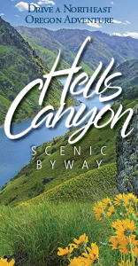
ClosedThe route of the Hells Canyon Scenic Byway is a loop that encircles the Wallowa Mountains, intersecting with Interstate 84 at La Grande and Baker City.
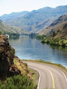
Small towns, scattered along the drive, offer visitor services. The entire route is on a paved highway. Plan ahead – you’ll find stretches of more than eighty miles without gas and with few services. A segment of the Byway between Joseph and Halfway closes with snow in winter, but allows access to winter recreation areas, offering a whole other kind of Northeast Oregon adventure. Visitor information for communities in each of the three counties through which the byway passes is available by clicking the links in the list of cities below. Find visitor information and plan your visit to the entire region at visiteasternoregon.com. There are five ports of entry into the Byway:
 To encompass the entire route, the itinerary under Towns & Country on this website follows the Byway traveling from La Grande to Baker City, but driving the route in reverse is just as appealing.
See Map | See Byway Segment Details
You can drive the Byway in about four to five hours, but to really enjoy it, you will need a few days. We recommend you reserve lodging accommodations prior to your trip.
Here is a list of mileage for several byway segments and side trips:
Although the digital world is great, we still strongly recommend people pick up a free official Oregon State Highway map, put out by the Oregon Department of Transportation, for travels throughout Oregon, available at visitor centers throughout Oregon. Ask for the free Hells Canyon Scenic Byway brochure and the new Hells Canyon & Wallowa Mountains Outdoor Recreation map to keep all the important travel and recreation information available throughout your journey. You may also want a Wallowa-Whitman National Forest Map for recreation in the mountains of northeast Oregon, including the HCSB. Purchase these maps at any Forest Service District Ranger office (Baker City, La Grande, Joseph, Halfway) and many other locations.
Before starting out, take notice of the travel times as well as mileage between stops and keep your fuel tank as full as possible.
If you plan to hike, ski, snowmobile or otherwise explore off the main Byway routes, pick up detailed maps and additional information from the offices listed on the links shown above.
Be prepared for temperatures that vary as much as fifty degrees as the day wears on and as you gain and lose elevation.
Remember to take along plenty of drinking water, your camera, binoculars, a picnic or snack foods, plant and wildlife guides, first aid kit, a blanket and jackets.
Unless familiar with the byway country, please stay on the byway proper or the identified side trips. Do not rely only on GPS generated driving instructions as they may lead to little traveled roads or roads that are not suitable for passenger vehicles or closed seasonally.