Wallowa Mountain Loop Road is:
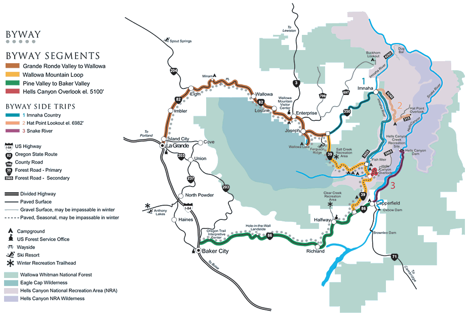
ClosedPlease enjoy the various digital & print Scenic Byway Maps available to the public. It’s important to remember that for the majority of the Byway you will be driving through natural regions with limited services. We’ve noted on the Color-Coded Map the locations of notable towns & campsites. Please plan accordingly.
For mileage between segments of the byway, go to our Route Information page.